| diagram | 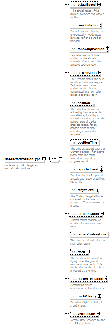 |
||
| namespace | http://www.fixm.aero/ext/nas/4.3 | ||
| children | nas:actualSpeed nas:coastIndicator nas:followingPosition nas:nextPosition nas:position nas:positionTime nas:reportedLevel nas:targetLevel nas:targetPosition nas:targetPositionTime nas:track nas:trackAcceleration nas:trackVelocity nas:verticalRate | ||
| used by |
|
||
| annotation |
|
||
| source | <xs:complexType name="NasAircraftPositionType"> <xs:annotation> <xs:documentation>Container for NAS target and track aircraft positions.</xs:documentation> </xs:annotation> <xs:sequence> <xs:element name="actualSpeed" type="fb:GroundSpeedType" nillable="true" minOccurs="0" maxOccurs="1"> <xs:annotation> <xs:documentation> The actual speed of the aircraft, collected via various methods.</xs:documentation> </xs:annotation> </xs:element> <xs:element name="coastIndicator" type="nas:NasCoastIndicatorType" nillable="true" minOccurs="0" maxOccurs="1"> <xs:annotation> <xs:documentation>An indicator the aircraft was unexpectedly not detected by radar (after a period of tracking).</xs:documentation> </xs:annotation> </xs:element> <xs:element name="followingPosition" type="nas:PlannedReportingPositionType" nillable="true" minOccurs="0" maxOccurs="1"> <xs:annotation> <xs:documentation>Estimated second future position of the aircraft transmitted in a non-radar airspace position report.</xs:documentation> </xs:annotation> </xs:element> <xs:element name="nextPosition" type="nas:PlannedReportingPositionType" nillable="true" minOccurs="0" maxOccurs="1"> <xs:annotation> <xs:documentation>For Oceanic flights, the next reporting position is required. Estimated next future position of the aircraft transmitted in a non-radar airspace position report.</xs:documentation> </xs:annotation> </xs:element> <xs:element name="position" type="fb:SignificantPointChoiceType" nillable="true" minOccurs="0" maxOccurs="1"> <xs:annotation> <xs:documentation>The actual location of an active flight as reported by surveillance, for a flight tracked by radar, or from the position part of a pilot progress report, for an oceanic flight or flight operating in non-radar airspace. </xs:documentation> </xs:annotation> </xs:element> <xs:element name="positionTime" type="fb:TimeType" nillable="true" minOccurs="0" maxOccurs="1"> <xs:annotation> <xs:documentation>The time associated with the Current Position of an active flight, from the radar surveillance report or progress report.</xs:documentation> </xs:annotation> </xs:element> <xs:element name="reportedLevel" type="nas:ReportedLevelType" nillable="true" minOccurs="0" maxOccurs="1"> <xs:annotation> <xs:documentation>Provides the NAS reported altitude with optional suffixes (B, C, T).</xs:documentation> </xs:annotation> </xs:element> <xs:element name="targetLevel" type="nas:TargetLevelType" nillable="true" minOccurs="0" maxOccurs="1"> <xs:annotation> <xs:documentation>The Mode C target altitude, corrected for barometric pressure. Can be marked as invalid.</xs:documentation> </xs:annotation> </xs:element> <xs:element name="targetPosition" type="fb:GeographicalPositionType" nillable="true" minOccurs="0" maxOccurs="1"> <xs:annotation> <xs:documentation>Aircraft target position, as reported by one raw radar return.</xs:documentation> </xs:annotation> </xs:element> <xs:element name="targetPositionTime" type="fb:TimeType" nillable="true" minOccurs="0" maxOccurs="1"> <xs:annotation> <xs:documentation>The time associated with the raw radar return.</xs:documentation> </xs:annotation> </xs:element> <xs:element name="track" type="fb:BearingType" nillable="true" minOccurs="0" maxOccurs="1"> <xs:annotation> <xs:documentation>The direction the aircraft is flying, over the ground, relative to true north. It is the heading of the aircraft as impacted by the wind.</xs:documentation> </xs:annotation> </xs:element> <xs:element name="trackAcceleration" type="nas:NasAccelerationType" nillable="true" minOccurs="0" maxOccurs="1"> <xs:annotation> <xs:documentation>Describes a flight's acceleration in X and Y axes.</xs:documentation> </xs:annotation> </xs:element> <xs:element name="trackVelocity" type="nas:NasVelocityType" nillable="true" minOccurs="0" maxOccurs="1"> <xs:annotation> <xs:documentation>Describes flight's velocity in X and Y axes.</xs:documentation> </xs:annotation> </xs:element> <xs:element name="verticalRate" type="nas:NasVerticalRateType" nillable="true" minOccurs="0" maxOccurs="1"> <xs:annotation> <xs:documentation>Vertical Rate reported by the STDDS System.</xs:documentation> </xs:annotation> </xs:element> </xs:sequence> </xs:complexType> |
element NasAircraftPositionType/actualSpeed
| diagram | 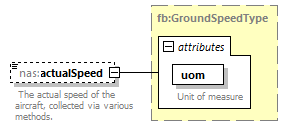 |
||||||||||||||
| namespace | http://www.fixm.aero/ext/nas/4.3 | ||||||||||||||
| type | fb:GroundSpeedType | ||||||||||||||
| properties |
|
||||||||||||||
| facets |
|
||||||||||||||
| attributes |
|
||||||||||||||
| annotation |
|
||||||||||||||
| source | <xs:element name="actualSpeed" type="fb:GroundSpeedType" nillable="true" minOccurs="0" maxOccurs="1"> <xs:annotation> <xs:documentation> The actual speed of the aircraft, collected via various methods.</xs:documentation> </xs:annotation> </xs:element> |
element NasAircraftPositionType/coastIndicator
| diagram | 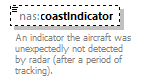 |
||||||||
| namespace | http://www.fixm.aero/ext/nas/4.3 | ||||||||
| type | nas:NasCoastIndicatorType | ||||||||
| properties |
|
||||||||
| facets |
|
||||||||
| annotation |
|
||||||||
| source | <xs:element name="coastIndicator" type="nas:NasCoastIndicatorType" nillable="true" minOccurs="0" maxOccurs="1"> <xs:annotation> <xs:documentation>An indicator the aircraft was unexpectedly not detected by radar (after a period of tracking).</xs:documentation> </xs:annotation> </xs:element> |
element NasAircraftPositionType/followingPosition
| diagram | 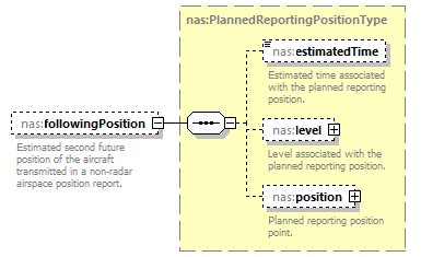 |
||||||||
| namespace | http://www.fixm.aero/ext/nas/4.3 | ||||||||
| type | nas:PlannedReportingPositionType | ||||||||
| properties |
|
||||||||
| children | nas:estimatedTime nas:level nas:position | ||||||||
| annotation |
|
||||||||
| source | <xs:element name="followingPosition" type="nas:PlannedReportingPositionType" nillable="true" minOccurs="0" maxOccurs="1"> <xs:annotation> <xs:documentation>Estimated second future position of the aircraft transmitted in a non-radar airspace position report.</xs:documentation> </xs:annotation> </xs:element> |
element NasAircraftPositionType/nextPosition
| diagram | 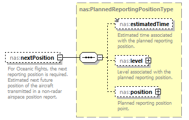 |
||||||||
| namespace | http://www.fixm.aero/ext/nas/4.3 | ||||||||
| type | nas:PlannedReportingPositionType | ||||||||
| properties |
|
||||||||
| children | nas:estimatedTime nas:level nas:position | ||||||||
| annotation |
|
||||||||
| source | <xs:element name="nextPosition" type="nas:PlannedReportingPositionType" nillable="true" minOccurs="0" maxOccurs="1"> <xs:annotation> <xs:documentation>For Oceanic flights, the next reporting position is required. Estimated next future position of the aircraft transmitted in a non-radar airspace position report.</xs:documentation> </xs:annotation> </xs:element> |
element NasAircraftPositionType/position
| diagram | 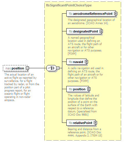 |
||||||||
| namespace | http://www.fixm.aero/ext/nas/4.3 | ||||||||
| type | fb:SignificantPointChoiceType | ||||||||
| properties |
|
||||||||
| children | fb:aerodromeReferencePoint fb:designatedPoint fb:navaid fb:position fb:relativePoint | ||||||||
| annotation |
|
||||||||
| source | <xs:element name="position" type="fb:SignificantPointChoiceType" nillable="true" minOccurs="0" maxOccurs="1"> <xs:annotation> <xs:documentation>The actual location of an active flight as reported by surveillance, for a flight tracked by radar, or from the position part of a pilot progress report, for an oceanic flight or flight operating in non-radar airspace. </xs:documentation> </xs:annotation> </xs:element> |
element NasAircraftPositionType/positionTime
| diagram | 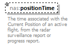 |
||||||||
| namespace | http://www.fixm.aero/ext/nas/4.3 | ||||||||
| type | fb:TimeType | ||||||||
| properties |
|
||||||||
| facets |
|
||||||||
| annotation |
|
||||||||
| source | <xs:element name="positionTime" type="fb:TimeType" nillable="true" minOccurs="0" maxOccurs="1"> <xs:annotation> <xs:documentation>The time associated with the Current Position of an active flight, from the radar surveillance report or progress report.</xs:documentation> </xs:annotation> </xs:element> |
element NasAircraftPositionType/reportedLevel
| diagram | 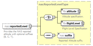 |
||||||||
| namespace | http://www.fixm.aero/ext/nas/4.3 | ||||||||
| type | nas:ReportedLevelType | ||||||||
| properties |
|
||||||||
| children | fb:altitude fb:flightLevel nas:suffix | ||||||||
| annotation |
|
||||||||
| source | <xs:element name="reportedLevel" type="nas:ReportedLevelType" nillable="true" minOccurs="0" maxOccurs="1"> <xs:annotation> <xs:documentation>Provides the NAS reported altitude with optional suffixes (B, C, T).</xs:documentation> </xs:annotation> </xs:element> |
element NasAircraftPositionType/targetLevel
| diagram | 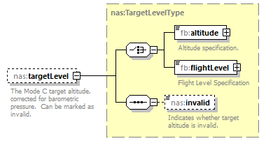 |
||||||||
| namespace | http://www.fixm.aero/ext/nas/4.3 | ||||||||
| type | nas:TargetLevelType | ||||||||
| properties |
|
||||||||
| children | fb:altitude fb:flightLevel nas:invalid | ||||||||
| annotation |
|
||||||||
| source | <xs:element name="targetLevel" type="nas:TargetLevelType" nillable="true" minOccurs="0" maxOccurs="1"> <xs:annotation> <xs:documentation>The Mode C target altitude, corrected for barometric pressure. Can be marked as invalid.</xs:documentation> </xs:annotation> </xs:element> |
element NasAircraftPositionType/targetPosition
| diagram | 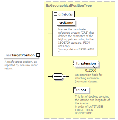 |
||||||||||||||
| namespace | http://www.fixm.aero/ext/nas/4.3 | ||||||||||||||
| type | fb:GeographicalPositionType | ||||||||||||||
| properties |
|
||||||||||||||
| children | fb:extension fb:pos | ||||||||||||||
| attributes |
|
||||||||||||||
| annotation |
|
||||||||||||||
| source | <xs:element name="targetPosition" type="fb:GeographicalPositionType" nillable="true" minOccurs="0" maxOccurs="1"> <xs:annotation> <xs:documentation>Aircraft target position, as reported by one raw radar return.</xs:documentation> </xs:annotation> </xs:element> |
element NasAircraftPositionType/targetPositionTime
| diagram | 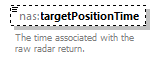 |
||||||||
| namespace | http://www.fixm.aero/ext/nas/4.3 | ||||||||
| type | fb:TimeType | ||||||||
| properties |
|
||||||||
| facets |
|
||||||||
| annotation |
|
||||||||
| source | <xs:element name="targetPositionTime" type="fb:TimeType" nillable="true" minOccurs="0" maxOccurs="1"> <xs:annotation> <xs:documentation>The time associated with the raw radar return.</xs:documentation> </xs:annotation> </xs:element> |
element NasAircraftPositionType/track
| diagram | 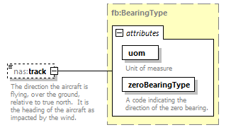 |
||||||||||||||||||||||
| namespace | http://www.fixm.aero/ext/nas/4.3 | ||||||||||||||||||||||
| type | fb:BearingType | ||||||||||||||||||||||
| properties |
|
||||||||||||||||||||||
| facets |
|
||||||||||||||||||||||
| attributes |
|
||||||||||||||||||||||
| annotation |
|
||||||||||||||||||||||
| source | <xs:element name="track" type="fb:BearingType" nillable="true" minOccurs="0" maxOccurs="1"> <xs:annotation> <xs:documentation>The direction the aircraft is flying, over the ground, relative to true north. It is the heading of the aircraft as impacted by the wind.</xs:documentation> </xs:annotation> </xs:element> |
element NasAircraftPositionType/trackAcceleration
| diagram | 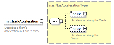 |
||||||||
| namespace | http://www.fixm.aero/ext/nas/4.3 | ||||||||
| type | nas:NasAccelerationType | ||||||||
| properties |
|
||||||||
| children | nas:x nas:y | ||||||||
| annotation |
|
||||||||
| source | <xs:element name="trackAcceleration" type="nas:NasAccelerationType" nillable="true" minOccurs="0" maxOccurs="1"> <xs:annotation> <xs:documentation>Describes a flight's acceleration in X and Y axes.</xs:documentation> </xs:annotation> </xs:element> |
element NasAircraftPositionType/trackVelocity
| diagram | 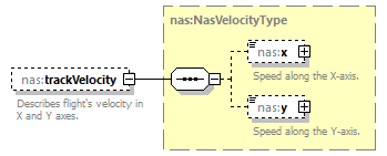 |
||||||||
| namespace | http://www.fixm.aero/ext/nas/4.3 | ||||||||
| type | nas:NasVelocityType | ||||||||
| properties |
|
||||||||
| children | nas:x nas:y | ||||||||
| annotation |
|
||||||||
| source | <xs:element name="trackVelocity" type="nas:NasVelocityType" nillable="true" minOccurs="0" maxOccurs="1"> <xs:annotation> <xs:documentation>Describes flight's velocity in X and Y axes.</xs:documentation> </xs:annotation> </xs:element> |
element NasAircraftPositionType/verticalRate
| diagram | 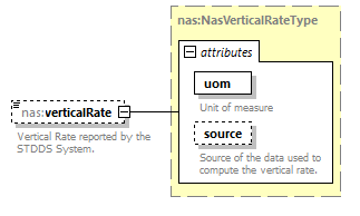 |
||||||||||||||||||||||
| namespace | http://www.fixm.aero/ext/nas/4.3 | ||||||||||||||||||||||
| type | nas:NasVerticalRateType | ||||||||||||||||||||||
| properties |
|
||||||||||||||||||||||
| attributes |
|
||||||||||||||||||||||
| annotation |
|
||||||||||||||||||||||
| source | <xs:element name="verticalRate" type="nas:NasVerticalRateType" nillable="true" minOccurs="0" maxOccurs="1"> <xs:annotation> <xs:documentation>Vertical Rate reported by the STDDS System.</xs:documentation> </xs:annotation> </xs:element> |
XML Schema documentation generated by XMLSpy Schema Editor http://www.altova.com/xmlspy